El Camino Real de los Tejas National Historic Trail
Crossing parts of Texas and Louisiana, El Camino Real de los Tejas National Historic Trail is a long-distance national trail under National Park Service oversight — experienced by segment, section, or full thru-hike. Explore a diverse array of histories contained within El Camino Real de los Tejas’ 150-year life, including the Spanish struggle to missionize American Indian nations, the growth of cattle ranching in the Mexican period, and the movement for Texan independence and statehood.
Weather windows matter on El Camino Real de los Tejas National Historic Trail. Plan around them, not through them, and the trail tends to treat you well.
Because El Camino Real de los Tejas National Historic Trail is a long-distance trail, visitors should match their plan to their skills, season, and the specific segment they intend to hike.
Key Highlights
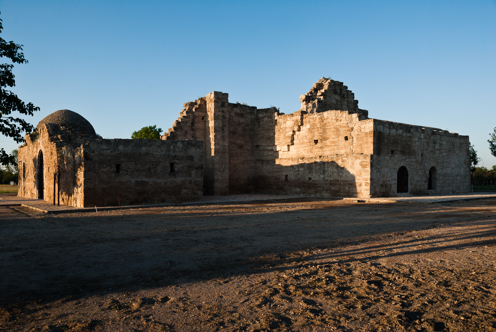
- Architecture and Building
- Archeology
- Arts
- Photography
- Museum Exhibits
Getting There
Reaching El Camino Real de los Tejas National Historic Trail is straightforward once you know the route. You can visit many sites of the El Camino Real de los Tejas National Historic Trail over the 2,580-mile historic route that crosses 2 states, and travels into Mexico, to Mexico City.
By Car
Most visitors arrive by private vehicle or rental car. Road conditions vary with weather and construction, so check the park's alerts page the day before you travel. Pay attention to GPS directions in rural stretches—some apps route drivers onto unmaintained service roads rather than the signed park entrance.
Nearest Airports
Regional airports provide the most convenient access for long-distance travelers. For the most current airline service and driving distances, cross-reference flight options with the park's contact page. Budget extra drive time from any airport, especially if you arrive after dark or during winter weather.
Public Transit and Tours
Direct public transit is limited at most National Park Service sites, but guided day tours and shuttles sometimes operate from nearby cities during peak season. Rideshare options are often reliable in gateway towns but may drop off outside the park boundary rather than at specific trailheads or visitor centers.
For turn-by-turn directions and current road status, consult the park's official directions page: http://www.nps.gov/elte/planyourvisit/directions.htm.
Best Time to Visit
Weather shapes every visit. Due to the length of El Camino de los Tejas National Historic Trail, be sure to consult local weather sources for the region you'll be visiting. Check out the forecast with the National Weather Service and search for the area you'd like to visit: www.weather.gov
Spring (March – May)
Spring opens lower elevations first, with higher segments still snowbound. Water crossings can be tricky during melt.
Summer (June – August)
Summer is the main thru-hiking season, with long days and reliable trail town services.
Fall (September – November)
Fall offers stable weather, cooler hiking, and reduced bug pressure, though services taper off in some regions.
Winter (December – February)
Winter travel on the trail requires specialized skills and gear; most visitors choose snowshoe or ski day trips on low-elevation segments.
Activities and Adventures
Activities at El Camino Real de los Tejas National Historic Trail reflect the character of the site. The options below are drawn from the park's current published list—confirm availability and any required reservations before planning around a specific activity.
- Auto and ATV — ask at the visitor center for current conditions, reservations, and any required permits.
- Scenic Driving — ask at the visitor center for current conditions, reservations, and any required permits.
- Junior Ranger Program — schedules rotate seasonally; check the visitor center board on arrival for the current lineup.
- Museum Exhibits — the visitor center is the best first stop for context, maps, and current program information.
Ranger-led programs are often the highest-value activity for first-time visitors, combining interpretation with access you might miss on your own. Check program schedules at the visitor center on arrival.
Wildlife and Natural Features
Although El Camino Real de los Tejas National Historic Trail is best known to many visitors for its recreation and scenery, it also protects the ecosystems that make those experiences possible.
Featured interpretive themes include Architecture and Building, Archeology, Arts, Photography, Colonization and Settlement, Commerce.
Habitats and Ecosystems
The park's habitats support a cross-section of regional wildlife. Observing species in their native context is one of the most rewarding—and most overlooked—reasons to slow down during a visit.
Viewing Wildlife Responsibly
Give animals room, never feed them, and store food properly where bears or other scavengers are present. Use binoculars or a telephoto lens for close-up views rather than approaching.
Night Skies and Quiet
Many NPS units are increasingly valued as dark-sky and natural-quiet refuges. If your visit overlaps with a clear, moonless night, step away from artificial lighting and let your eyes adjust.
Lodging and Camping
Lodging strategy depends on how long you plan to stay at El Camino Real de los Tejas National Historic Trail and what you want to do when you are not at the park.
On-Site Stays
Overnight accommodations inside the park's boundary are limited or not offered here. Most visitors stay in nearby towns and commute in each day.
Gateway Towns and Nearby Lodging
Communities close to the park offer a mix of chain hotels, independent inns, vacation rentals, and—depending on location—bed-and-breakfasts. Several Texas and Louisiana towns serve as convenient bases, with restaurants, fuel, and grocery resupply. Book well ahead for summer weekends and major holidays.
Operating Hours and Seasons
El Camino Real de los Tejas National Historic Trail: El Camino Real de los Tejas National Historic Trail is not a clearly marked hiking trail. Instead it is a route that passes through communities, urban areas, public lands, and Wilderness. The route travels across a variety of land ownerships and management, including private land. Each location varies as to the hours of operations and access. Please contact individual trail sites before your visit for more information.
Essential Information
Fees and Passes
No standard entrance fee is charged. Some special programs or partner-run facilities within the park may carry their own fees, so confirm before booking anything ticketed.
Contact
- Phone: N/A
- Email: [email protected]
- Official site: https://www.nps.gov/elte/index.htm
Safety
Carry water, sun protection, and layered clothing appropriate for the season. Cell coverage can be spotty in parts of the park—download offline maps before you leave your lodging. In an emergency, dial 911 or contact the nearest ranger station.
Services and Accessibility
Main visitor centers typically offer accessible restrooms, interpretive exhibits, bookstore sales, and ranger assistance. Accessibility varies by building and trail; contact the park ahead of time to discuss specific needs. Pets are often allowed on leash in designated areas only—check current rules before bringing animals.
Regulations to Know
Drones are prohibited in nearly all National Park Service units without a special permit. Metal detecting, collection of natural or cultural objects, and off-trail travel in sensitive areas are also commonly restricted. Read the signs at each trailhead and ask a ranger if you are unsure.
At El Camino Real de los Tejas National Historic Trail, return trips beat first trips almost every time. That is how long trails work.
Real satellite imagery on NASA elevation — orbit the peaks at true scale.
Explore in 3D →What the park will quietly do to you.
Heat & Sun
SummerSummer highs can hit 100°F+ in many western parks. Carry 2 L of water per person minimum and avoid strenuous activity 10am–4pm.
Wildlife
Year-roundKeep 100 yards from bears and wolves, 25 from everything else. Never feed wildlife — it changes their behavior and ends with the animal euthanized.
Weather windows
SummerHigh-country thunderstorms build fast in summer afternoons. Plan to be off exposed ridges by noon, especially July–September.
Permits & timed entry
Plan aheadSeveral parks require timed-entry reservations or wilderness permits. Reserve weeks ahead via recreation.gov — same-day windows are limited.
Hero photo: Christopher Talbot


